Sustainability Nexus Analytics, Informatics, and Data (AID) Programme

LAND USE AND LAND COVER CHANGE
WHY DOES LAND USE LAND COVER CHANGE
MATTER?
Land Use and Land Cover Change (LULCC) matter to society as they underpin the intricate relationship between human activities and the environment. LULCC influences essential aspects of our lives, from resource management to climate change, with repercussions for biodiversity and human well-being. Unsustainable land use practices can lead to resource depletion, habitat loss, and increased greenhouse gas emissions, thus directly affecting society's access to vital resources and exacerbating the challenges posed by climate change. At its core, the significance of LULCC for society lies in its profound and far-reaching effects on our collective well-being. Understanding the consequences of unsustainable land use practices is crucial as they impact our access to resources, the stability of ecosystems, and our ability to address pressing challenges such as food security and climate change. In this context, responsible land management emerges as a crucial factor in building resilient societies that can thrive in a changing world, fostering sustainability and ensuring a better quality of life for all.
WHY A NEXUS APPROACH?
Understanding land use and land cover change necessitates a NEXUS approach due to its intricate role in the broader sustainability agenda. Land use and land cover are pivotal components in the coupled human-environment system, with direct links to climate change, nature degradation, and pollution. The Sustainability Nexus AID Research Programme at the United Nations University recognizes that addressing these complex challenges requires a comprehensive approach that bridges science, policy, and society. By adopting a NEXUS perspective, we can better comprehend the interdependencies between land use changes and their far-reaching impacts on global and regional scales, thereby facilitating collaborative efforts to meet the 2030 Sustainable Development Goals. In a world of increasing complexity, the NEXUS approach empowers academics, businesses, policymakers, and international organizations to navigate this terrain effectively, fostering informed decision-making and sustainable outcomes for the benefit of our planet and societies.
AID TOOLS
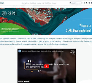
System for Earth Observation Data Access, Processing and Analysis for Land Monitoring (SEPAL)
SEPAL (System for Earth Observation Data Access, Processing and Analysis for Land Monitoring) is an open-source project and platform empowering people around the world to gain a better understanding of land cover dynamics by facilitating the efficient access and use of Earth observation data – without the need of coding knowledge.
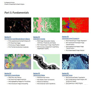
Cloud-Based Remote Sensing with Google Earth Engine (GEE book)
This book is the product of more than a year of effort from over 100 individuals who worked together to provide this free resource for learning how to use this exciting technology for the public good. The book is broadly organized into two sections:
Fundamentals (The first half, Fundamentals, consists of 31 labs designed to take from being a complete Earth Engine novice to becoming a quite advanced user).
Applications (The second half, Applications, provides a tour of the world of Earth Engine across 24 chapters, demonstrating how it is used in a wide variety of settings that rely on remote-sensing data).
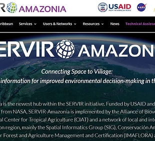
Caribbean trainings
SERVIR-Amazonia is the newest hub within the SERVIR initiative. Funded by USAID and with science and technology support from NASA, SERVIR-Amazonia is implemented by the Alliance of Bioversity International and the International Center for Tropical Agriculture (CIAT) and a network of local and international partners serving the Amazon region, mainly the Spatial Informatics Group (SIG), Conservación Amazónica (ACCA), the Institute for Forest and Agriculture Management and Certification (IMAFLORA) and Fundación EcoCiencia
Learning for Nature
Learning for Nature is a premier e-learning programme offered by the United Nations Development Programme (UNDP). This programme connects biodiversity policymakers, change-makers, and on-the-ground subject matter experts to promote biodiversity conservation and facilitate the achievement of the Sustainable Development Goals.
OpenMRV
OpenMRV is a free open-source platform providing access to forest-related MRV-support resources, such as training materials, tool manuals and technical guidance. Country documentation examples of standard operating procedures (SOPs), manuals, and calculations examples are also available. It provides practical support resources that countries can use with their existing systems to generate mid or final outputs relevant to achieving set national MRV objectives. OpenMRV serves as a living library where countries can archive and access current and older versions of shared MRV-support resources.
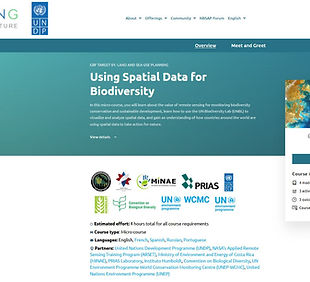
FREE micro-course "Using Spatial Data for Biodiversity"
NASA's Applied Remote Sensing Training Program (ARSET) and the United Nations Development Programme (UNDP) are collaborating to provide a free micro-course titled "Using Spatial Data for Biodiversity." This course is designed to help individuals learn about and utilize spatial data for biodiversity-related purposes.
Get to Know AID Members
You can consult with the AID group leader or any members for your regional, national, and global datasets, tools, and analytics projects and questions.


